
Winter Hiking in Thorsmork without a Guide
I recently had the chance to visit Thorsmork, a valley in the Highlands of Iceland, in the end of October. It was magical to see the valley when covered in snow, although the weather was quite moody. Anyways, in order to write this article, I forced myself to still roam almost every single hiking path of the area. So here's a guide to winter hiking in Thorsmork.
About The Thorsmork Nature reserve
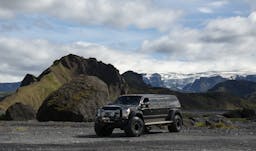
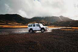
Thorsmork is located on the south coast of Iceland, in the highlands. It is a bit up north of the glacier of Eyjafjallajökull and between two other glaciers: Mýrdalsjökull and Tindfjallajökull. Thorsmork, (or “Þórsmörk” in Icelandic), means the “forest of Thor”. The climate there is a bit nicer than it usually is in the south of Iceland because it is sheltered from the winds by the surrounding mountains. It is almost inaccessible unless you are in a super jeep, most likely during a guided tour.
It is definitely a hiker’s paradise, with a tremendous amount of hiking paths in the valley, most of them not challenging at all. Of course, it is also well known for being the connection between the two most famous treks of the country: The Fimmvörðuháls and The Laugavegur hiking trail.
In this article, I will only write about hiking in Thorsmork, read “Thorsmork Valley: a Gem in the Highlands of Iceland” to get more information about the location itself and the practical information: transportation, accommodation etc. All information about hiking are provided considering The Thorsmork Volcano Huts as your starting point.
I first have to precise that I was invited there in order to write this article. Therefore, I want to thank Isafold Travel and Thorsmork Volcano Huts for this opportunity. I also must precise that there was no counterpart or any kind of sponsorship for this and that I write this article on a completely personal and unbiased opinion
Hiking the blue trail and the white trail of Thorsmork: “Thorsmork Panorama”
So, after we had a thorough look at the map, spoke with the staff of the volcano huts and decided that we did not want to go to a long hike because of the weather, we chose to begin with the blue trail. About the weather, it was windy, rainy, and foggy. Yes, it sounds bad, but actually, once properly geared up, it was oddly bearable. The visibility was not excellent but good enough, and fog created some ambiance to the landscapes around.
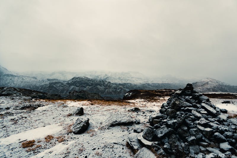
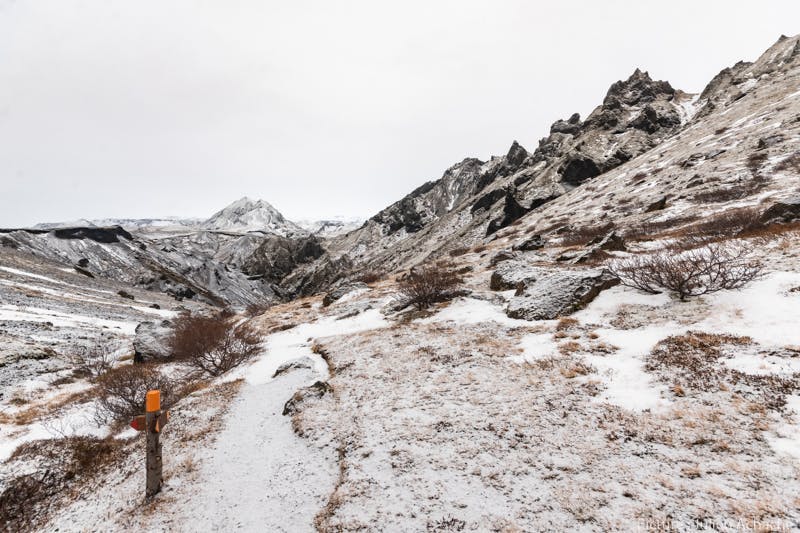
It is essential to ask the people at the reception for information. The trails might be slightly differently indicated on the map and on the trail itself. The blue trail is a good example. Actually, what is labeled as a blue trail on the map will actually be marked in blue on the path, but only for the first half. The second half will be marked as white. To end the loop, you will have to walk on the green trail, but this is correctly labeled on the map. So, to sum up, in order to walk it clockwise: Follow the blue poles from the Thorsmork Volcano Huts to the Langidalur valley, then the white poles to Valahnúkur, still follow the white poles down the hill, and finally, follow the green poles on your right to go back to the huts. If you see paths marked with red poles, they usually indicate shortcuts.
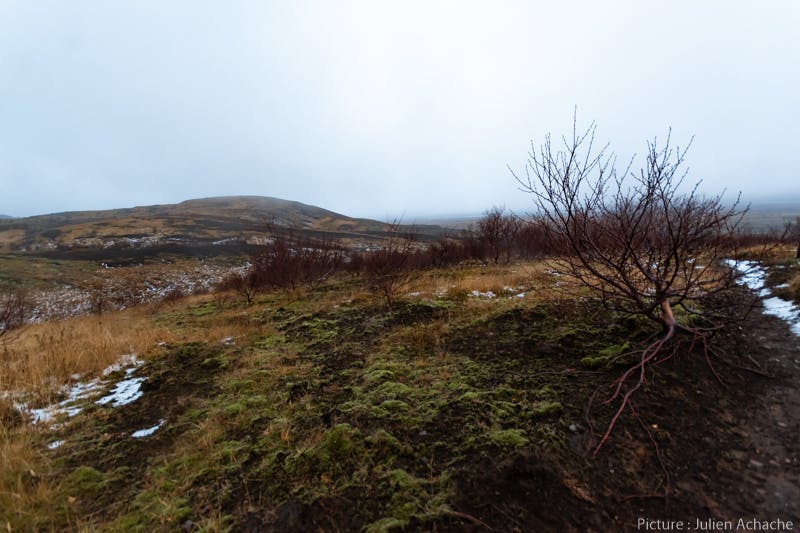
So we started our hike, the weather was still bad but clearing up. Not enough to give us great hopes to ever see the sun on that day though. The first thing you will notice on the path, especially if you already know a thing or two about Iceland, is that the area is pretty packed with trees. Mostly birches, of course, but there are a lot of them and they are actually among the tallest I have ever seen in Iceland. We first evolved in the lowlands of the valley, the path making us walk in the middle of the woods. The first snowfall happened the night before so the area was all white but still with autumn colors everywhere. Since there was not enough snow to completely cover the trails, it was easy to walk on them, and they were easy to follow.
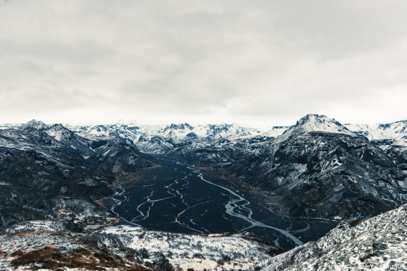
After a walk of more or less 30 minutes, you arrive in the valley of Langidalur. The place is absolutely beautiful. If you are actually doing the treks mentioned above: The Fimmvörðuháls and The Laugavegur, you will have to walk through that valley to connect them. I had the opportunity to do it in 2014, it was wonderful. I don’t know what will be the most stunning aspect of the place for you. For me, it was this flat, black ground that spreads as far as one can see, scattered with dozens of streams originating from the Krossá river. I found it gorgeous 4 years ago in summertime; I had the same feeling when I saw it this time in winter. What is also spectacular about it is that this place is surrounded by mountains anywhere you look. The mountains in Iceland are not really high, and one who already traveled in the Alps or the Himalaya for instance, might think they will not seem that impressive. But they still have something that makes them look quite imposing. One thing one will notice about Icelandic mountains is that you can very often see them entirely, from the bottom to the top. This gives a different perspective and makes them look taller than they really are. In this place, Langidalur, you can find some huts and a campsite. It is closed in the winter, but would be a perfect base camp in summertime.
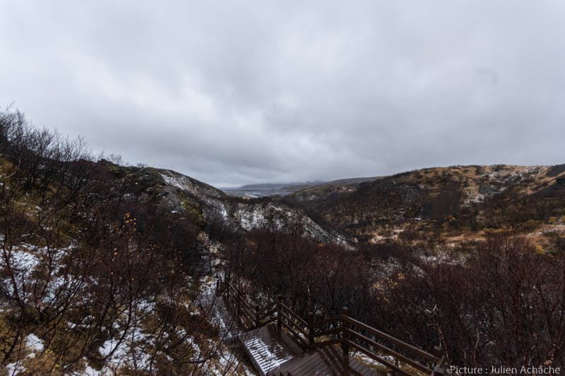
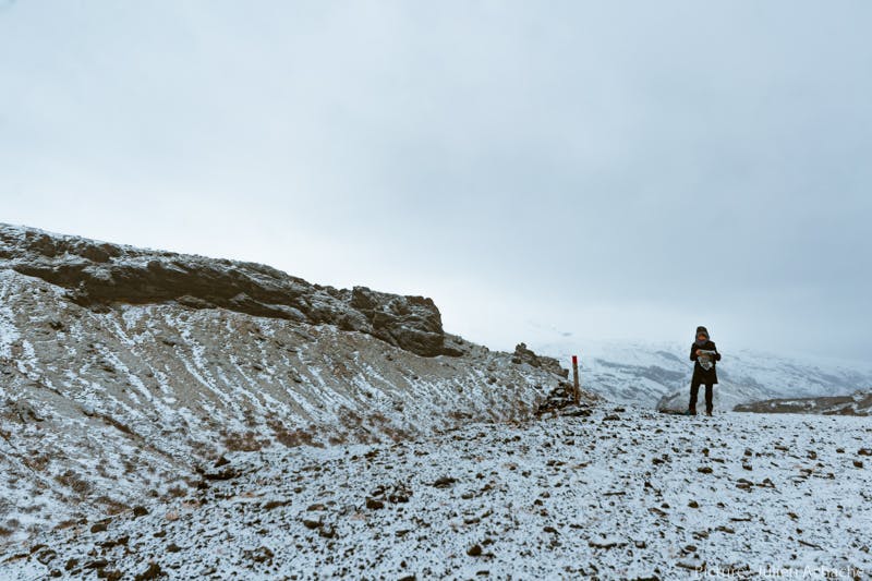
This first part of the hike (The one that is still labeled in blue) was flat and easy, there was absolutely no difficulty. The second part, marked with white poles, leads to Valahnúkur. This part might be a little bit trickier than the first one, even though it is the most popular hike of the area. You will have to walk a steep path up a hill of 454 meters high (approximately 1500 feet). There is no crazy difficulty there, but enough to take it into consideration if you are traveling with elders or young children. Especially in winter when it might be covered in snow, as it was for us. Also, I will never say it enough, weather can change very fast here in Iceland, and altitude is also a factor, and we felt it pretty clearly. By the time we reached the bottom of the hill, the wind calmed down and the rain as well. We realized soon enough that bad weather actually just climbed the hill faster than we did, It was terrible once at the summit
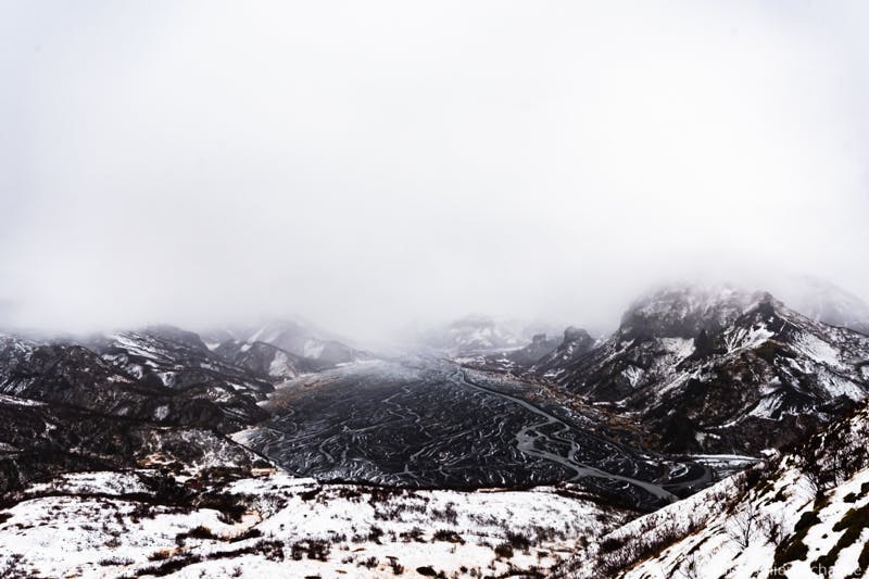
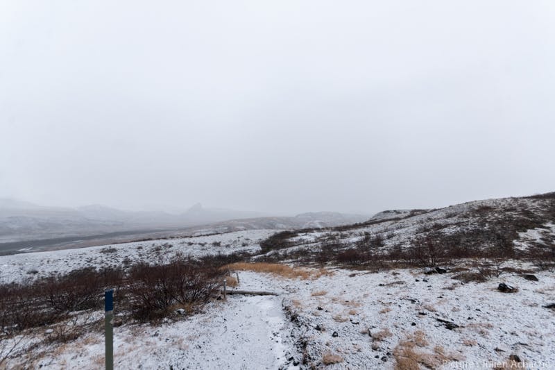
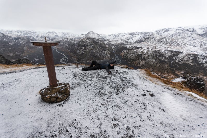
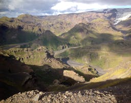
Anyway, you must go to the top, I would say Valahnúkur is the main attraction of the area, and probably the most famous viewpoint. Once you are up there, you understand why this trail is called “Thorsmork Panorama”. From up there, you will get a 360°C view on the whole valley, see all those streams of water I was talking about earlier and the surrounding mountains. There is a road at the bottom of the valley, if a car passes by, it will give you quite a scale of the immensity of Langidalur. The picture below shows what it looks like when the weather is not really clear, to see pictures with a clear weather, read towards the end of this article. Also note that if you do not feel like going all the way to the top for any reason, There is a nice point of view before the top, from where you can take a shortcut (red poles) to the way down.
Now it is time to head down the hill, toward the green trail. The way down is easy, although, a bit slippery when wet. When you are down the hill, take the green trail to the right to head to the huts. To the left, it would bring you to the trail of the Merkurrani Plateau. On your way down to the huts, you will walk in dense woods. When I say “dense” it is, of course, according to Icelandic standards. And you will get the opportunity to see Sönghellir (The singing cave) if you take a small path on your left.
The information provided on the map tell you that it takes two hours to/from the huts to complete the trail. Even though I, so far, often thought time estimations were always accurate when I went for a hike in Iceland, I think two hours is quite a lot. It actually took us less than one hour thirty minutes. Maybe around 75 minutes, and I did not feel like we sped up, we took some time to gaze at the valley when we were in Langidalur and to visit Sönghellir on the way back on the green trail. The other perk of this trail is that it can easily be connected to every other one.
Hiking the green trail of Thorsmork: “Merkurrani Plateau”
After our first hike, to be honest, because of the weather, we thought we were done with hiking for the day, we put on dry clothes and decided to chill in the lobby until dinner. Then, came this itchy feeling that something was not quite right about sitting there instead of being outside. All our clothes were wet and the weather was bad, for sure, but nothing dangerous. It was about 4:00pm so we had to make up our mind fast, otherwise we would not have time to hike another trail before nightfall. We ran back to our room, put our wet clothes on (what a pleasant feeling) and decided to head to the green trail, that would bring us up to the Merkurrani Plateau, which is 273 m high (around 820 feet).
We first walked back to the foothill of Valahnúkur, taking the part of the green trail that we took before, but the other way. We then turned right before the white trail. From there the path is really easy to follow and presents no difficulty, it was a friendly hike.
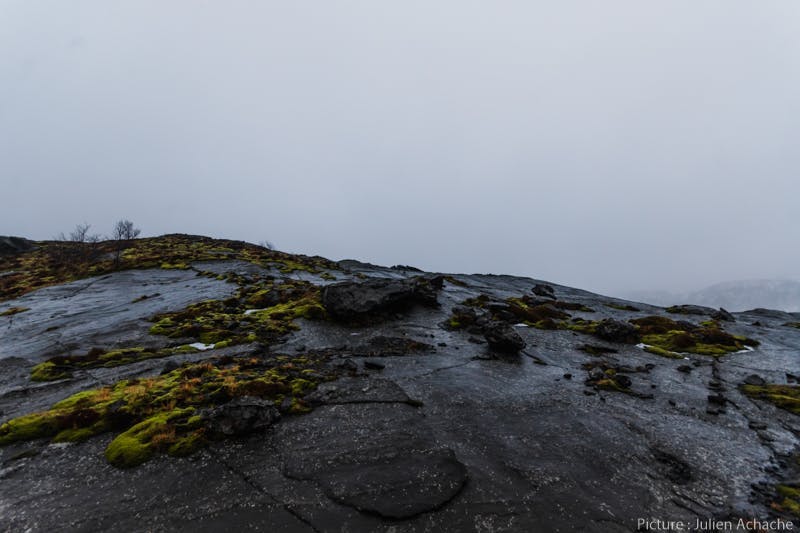
I must admit that as soon as we started to hike, the weather got slightly worse, and even though we still had some pretty enjoyable views at some points, it was mostly about walking under the rain with our heads down. Fortunately, it was more than that, but I would still like to do it again with better conditions. You will first walk between very tiny hills packed with a surprising amount of vegetation, and the autumnal colors in the fog made it rather magical. At this time, at this altitude, rain already cleared all the snow. You will encounter dark black rocks slightly covered with moss and also some colorful bushes on the way.
But really, this trail is more about bringing you close to sharp edges, with panoramic views on the valley. If you also did the blue and white trail before, you will still be surprised as you are actually walking the completely opposite way. Every single time the path brings you close to the cliffs, you will be able to witness how the Krossá river carved the valley into the volcanic rock throughout centuries.
From there, you will find your way down to the Markarfljót Riverbed, entirely made of black sands. The darkness of the sand contrasts sharply with the white mountains; and it is probably the same in the summertime when the mountains are green.
On the Markarfljót Riverbed, you will walk toward the Thorsmork Volcano Huts, with a landing strip on your left and cliffs to your right. Before the huts, you will notice some caves on the cliffs, those are the caves of Sóttarhellir, and you should take time to stop there briefly.
We made it before nightfall (around 6:30 pm in late October), and then took it easy in the lobby with a warm coffee and a hot dinner. This hike is really easy; the terrain is smooth, no ups and downs, and no steep parts. It is definitely suitable for a family hike. It is supposed to take 2 hours; once again, it took us way less.
Thorsmork: Second day of exploration
On a regular hiking day, we would have woken up early. With the weather we experienced the day before and also the fact that we expected something similar, we did not rush out of bed. When we finally woke up, we could see from our window that the weather was actually way better than the day before.
We were done with breakfast and dressing up around 10 am and we decided to start the red trail, named “Thorsmork Highlights”. We first asked for information at the front desk of the reception of the huts. The red trail “Thorsmork Highlights” shows some differences between the map and how it is indicated on the trail. At some point, you will walk on the trail of the Laugavegur trek and might follow a few blue square poles instead of the round red ones. If you have a doubt, here is the trick: If it is written LV on the poles, you are on the Laugavegur trek only and you made a mistake. If it is written LV, but also TM, then you are on the right trail, on the part that is common to both: The Thorsmork highlights trail and the Laugavegur trek. To be sure not to make any mistake, when you reach the first pile of stones, follow the path that leads to another one, up the hill. Ignore other paths.
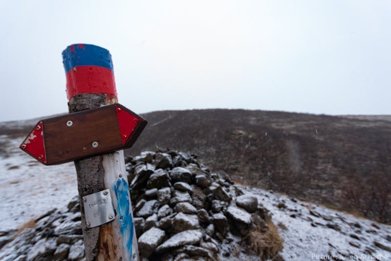
Another trick is that shortcuts on the trail are indicated with red, round poles, the same as on the main trail. So every time you are in doubt, just check your map, it should be obvious enough if you must turn or go straight ahead. When the person at the reception gave us all the details, he told us that nobody ever got lost nor made a mistake and started to venture on the wrong trail. So, no sorcery or rocket science here, you will find your way with basic common sense.
The Red trail: Thorsmork Highlights
The day before, I mentioned that everything was white due to the first snow that came the day before. But it was still a pretty thin layer of snow. Trails, for instance, were not completely white. Winter colors and autumn colors were blending. The second day, it was almost just white, with no wind, no rain, no fog but … still no sun either. Anyway, it was also not that cold, so I think we had among the best winter conditions one can expect.
This is a description of the trail if one does it clockwise.
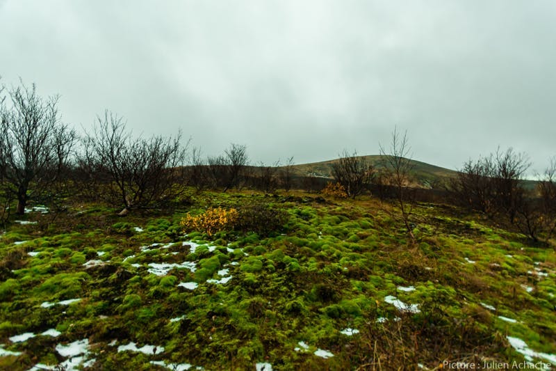
We began from the same trail as the day before, until we found the red poles. Then, the trail goes up a hill and it will be the only moment slightly steep. After that, the rest of the trail will be flat and relatively easy. Once you are up, you will venture in the middle of tiny birches until you reach the first cairn I mentioned before. During this part you do not get huge panoramas over the valley but, to us, walking in this small forest and making first footprints was still an amazing experience.
From this cairn, make sure you head to the next one up the hill, otherwise, you will be up for a 52 kilometers hike (32 miles) on The Laugavegur Trail. This is the part you might have to follow a few square blue poles. Once you will reach this second cairn, then you will be among the Tindfjöll mountains.
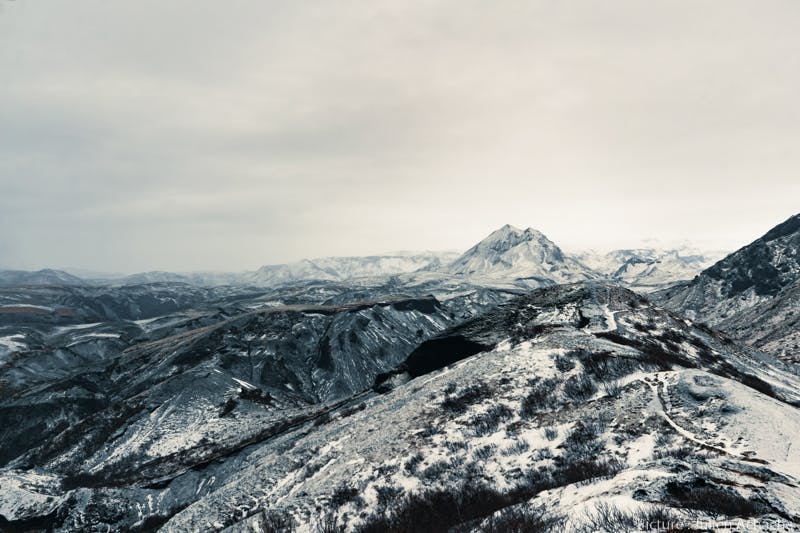
From now, you will be on the top of the hills for between one or two kilometers (about a mile). The walk is very easy, although snow might make it slightly tricky. It should be absolutely no problem in summer time. The day before, we sometimes encountered some huts, campsites or even roads while hiking. On this trail, the poles are the only mark of civilization, you feel as remote as one can be, deep into the Icelandic highlands. This feeling was especially enhanced by the snow on the trail, as we were setting the first footprints of the day.
Up the foothills of the Tindföll mountains, you will have a wonderful 360° panorama. On that day, everything was white around us and the view was gorgeous. I can only imagine what it looks like during other seasons when all those mountains are packed with different colors. What I now know for sure, is that I will definitely come back next summer.

A glimpse of the Orange trail: The Tindfjöll circle
Once you get down from the foothills of the Tindfjöll mountains, you can choose between staying on the red trail or switching to the orange one to head back to the huts, we chose the second option. Well, we “chose” the second option. The truth is more that at some point we could easily spot the orange pole but not the red one in our field of view. So we decided to continue on the orange trail.
In the bottom of this valley, you will evolve along a tiny stream and relatively tall birches. This is always a surprise how quickly landscape can change when you are hiking in Iceland, even to the point that it changes so much, it does not look like Iceland anymore. What I mean is that never I would have thought to walk in Iceland, in a forest with trees that still have leaves on their branches, while covered with snow. For sure, this part might be magical in summer too, but I am really happy I got the chance to see it in winter time.
Almost at the end of the trail, you will turn right and walk along the Krossá riverbed until you rejoin the blue and the white trail

The part of the orange trail that we did was very easy. Although I read that the rest of it is pretty challenging. So if you intend to hike the Tindfjöll circle, make sure you are ready for it.
The freedom of hiking many trails at once
One thing that made hiking in Thorsmork more unique than many places I have been hiking before, is that it is really easy to connect different trails together. As we did, you can easily decide to switch from one to another or to add one more hour of hiking of you feel like doing so.
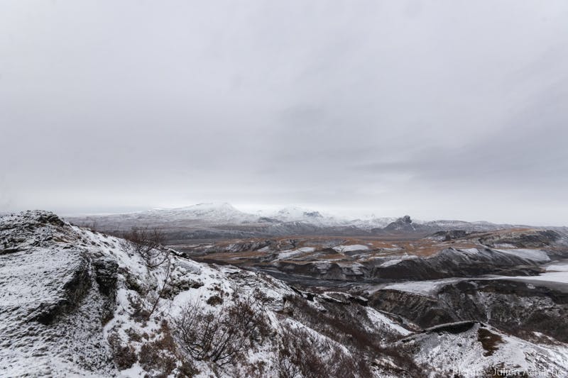
This is actually what we did. At the end of the Tindfjöll circle, we reached Langidalur again. We could have headed straight back to the huts, but instead, we decided to climb up to Valahnúkur again. The weather was much better than the day before and we were craving to admire this view once again and with a better visibility. The way up was harder this day though because the path and the steps were covered with a much thicker layer of snow. But once up there, we could not be happier to see the valley and the Króssa River once again.
I invite you to read more about Thorsmork in Thorsmork Valley: A Gem in The Highlands of Iceland.
People also like this
Sharing is caring!